
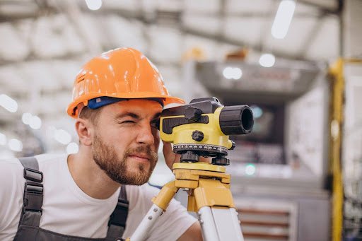
Construction projects rely on accurate measurements to translate architectural concepts and engineering designs into physical structures. From establishing building positions to checking elevations and aligning structural elements, every stage requires dependable site information. When measurements are inconsistent or incomplete, project teams may face design conflicts, construction delays and costly corrections. Engineering surveying helps address these challenges by connecting technical drawings with the actual conditions of a site.
Engineer surveyors play an important role in this process by collecting, verifying and interpreting measurements that support construction planning and execution. Their work can help engineers, architects, contractors and project managers understand spatial relationships, establish reference points and monitor whether construction activities follow the intended design. The precise responsibilities involved depend on the project’s scope, technical requirements and applicable professional standards.
Understanding the Role of Engineering Surveyors
Engineering surveying applies measurement techniques to the planning, construction and verification of infrastructure and built environments. Unlike activities limited to recording land boundaries, engineering surveys may support the positioning of structures, the establishment of levels, the alignment of roads and utilities, and the checking of constructed elements against approved drawings.
Surveyors work with project teams to establish reliable reference points and provide measurements in formats that can be used for design and construction. They may undertake surveys before work begins, provide setting-out information during construction and carry out verification measurements as activities progress. This continuity helps teams identify discrepancies early and make informed decisions before small errors affect subsequent work.
Establishing Reliable Site Data Before Construction
Every site has physical characteristics that influence the way a project can be developed. Ground levels, existing buildings, access routes, retaining structures and nearby infrastructure can affect proposed layouts. A survey provides measured information about these conditions, helping designers understand the site before finalising plans or committing resources to construction.
The quality of this initial information can influence several later decisions. For example, inaccurate elevation data may affect drainage design, while incorrect positional measurements can complicate the placement of foundations or service routes. A well-planned survey helps reduce dependence on estimates and provides a more consistent basis for technical coordination.
Supporting Setting-Out and Structural Alignment
Once a design has been approved, its dimensions and positions must be transferred accurately to the construction site. Setting-out activities establish the reference points, lines and levels needed to position foundations, columns, walls, roads and other structural elements. These measurements help construction teams understand where work should take place and how individual components relate to the overall design.
During this stage, engineer surveyors may use instruments such as total stations, digital levels and satellite-based positioning equipment, depending on the site’s conditions and required accuracy. Measurements must be checked against suitable control points and the relevant drawings. Clear communication is essential when discrepancies arise, because surveyors should not make unauthorised design changes; instead, the responsible engineer or project team must determine the appropriate response.
Why Accuracy Matters Across Project Stages
Construction accuracy depends on more than obtaining a single correct measurement. Reference systems must remain consistent, instruments must be used appropriately, and measurements must be verified as work progresses. If different teams use incompatible coordinates or levels, even individually precise measurements can create confusion when combined.
Regular checks can help identify deviations before they affect other construction activities. Depending on the project, verification may include checking elevations, confirming alignments or comparing completed work with design requirements. Documenting these checks creates a record that project stakeholders can review when assessing progress, investigating discrepancies or preparing subsequent work packages.
The Importance of Site Surveying in Dubai
Dubai’s construction environment includes residential developments, commercial buildings, transport infrastructure and large-scale mixed-use projects. These projects may involve complex site conditions, demanding schedules and coordination between multiple contractors and consultants. Accurate site information is therefore important for managing interfaces between proposed structures, existing infrastructure and surrounding properties.
Organisations arranging site surveying in dubai should identify the purpose of the survey before selecting a provider. A topographical survey, construction setting-out assignment and as-built survey serve different objectives, so the required deliverables should be defined clearly. Project owners should also confirm relevant local requirements, coordinate reference systems, site access arrangements and the format in which survey data must be supplied.
Using Modern Surveying Technology
Modern surveying combines established measurement principles with increasingly capable digital tools. Total stations can measure angles and distances, while GNSS equipment supports positioning where satellite signals and site conditions permit. Laser scanning can capture detailed information about visible surfaces, and digital workflows can help integrate survey data with computer-aided design models and building information modelling environments.
The suitability of a method depends on the environment and the information required. Satellite positioning may be less reliable near tall structures or in obstructed areas, while scanning may require additional processing and interpretation. Technology should therefore be selected according to the task rather than simply because it is available. Skilled operators, appropriate calibration and sound quality-control procedures remain essential to producing useful results.
Coordinating Surveyors with Engineers and Contractors
Surveying is most effective when it is integrated into the wider construction workflow. Engineers use measurements to inform design decisions, contractors rely on setting-out information to carry out work, and project managers use survey updates to coordinate activities and assess progress. Each group needs clear, consistent information that reflects the latest approved drawings and site conditions.
A structured communication process can help prevent outdated measurements from being used inadvertently. Teams should agree on drawing revisions, file formats, control points and procedures for reporting discrepancies. When unexpected site conditions are identified, the findings should be shared promptly with the relevant professionals so that the implications can be assessed before work continues.
Selecting an Engineering Surveying Provider
Choosing a surveying provider requires attention to the project’s technical needs and the provider’s ability to meet them. Relevant experience, equipment capability, quality-assurance procedures, reporting standards and communication practices are all useful considerations. Clients should also clarify the qualifications or authorisations required for the specific assignment under the applicable local rules.
Before work begins, the scope should identify the areas to be surveyed, the measurements required, the expected accuracy, the deliverable formats and the project schedule. It should also explain any exclusions or assumptions that could affect the results. A clear agreement helps prevent gaps between what the project team expects and what the surveying assignment is designed to provide.
Conclusion
Engineering surveying supports construction by providing dependable measurements for site assessment, setting-out, alignment and verification. When survey data is accurate, clearly documented and shared with the right stakeholders, it can strengthen coordination and help project teams address discrepancies before they become more difficult to resolve.
For developers and contractors planning construction work, the priority is to match the surveying approach to the site’s conditions and the project’s objectives. Lyca Survey supports project requirements through surveying and related technical services, helping teams establish a clearer understanding of site conditions and work with more reliable measurement information.